Ramble around Soto del Real and enjoy our village and its surroundings. Family-oriented routes with easy access, mountain routes, urban walks, bicycle trips, climbing, gastronomy, culture….
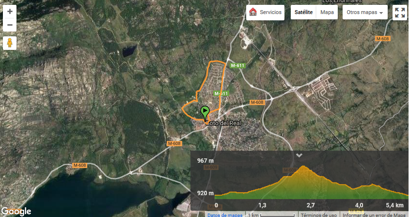
Green Belt
Hiking-mountain bike
Difficulty: low
Time required: 1-2 hours
Circular route where you will visit the most emblematic monuments of our village; it takes in the Cañada Real (Royal Drovers’ Road), where you will enjoy watching the storks and the ponds with amphibians; it then passes by the sports facilities, brining you back to the Plaza de la Villa (Town Square).
Download the whole route here.
Recuenco Stream
Hiking-mountain bike
Difficulty: low
Time required: 3-4 hours
This trek presents a low level of difficulty and is therefore for all the family, given that there are no steep hills and the route runs along paths or drovers’ roads.
Furthermore, some of this route takes you through quite unknown places where you can relax and enjoy the peace and quiet of these settings.
NOTE: the last stretch of road before reaching the Recuenco stream is not suitable for cycling.
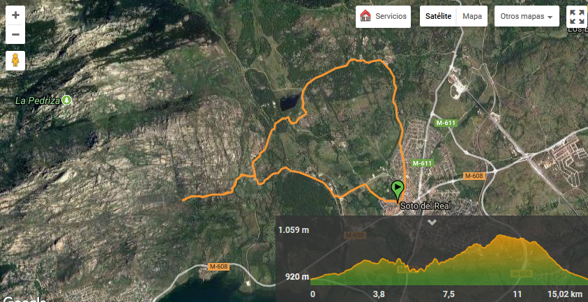
Download the whole route here.
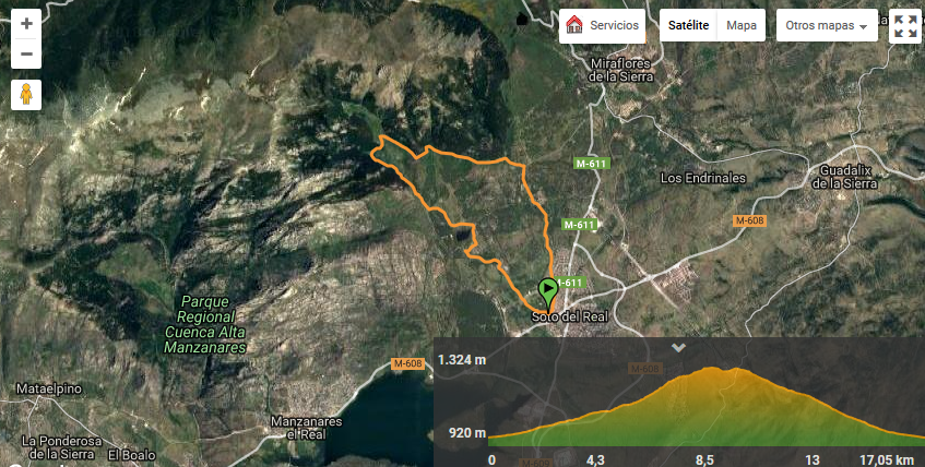
Collado de la Dehesilla mountain pass
Hiking
Difficulty: medium
Time required: 3-4 hours
This route runs mostly through little-travelled areas in which the traveller can enjoy the scenery and the quiet of the mountains.
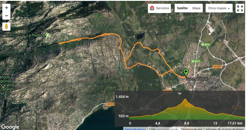
Download the whole route here.
Round Najarra peak
Hiking
Difficulty: high
Time required: 5-6 hours
This route is very long and warm clothing is recommended
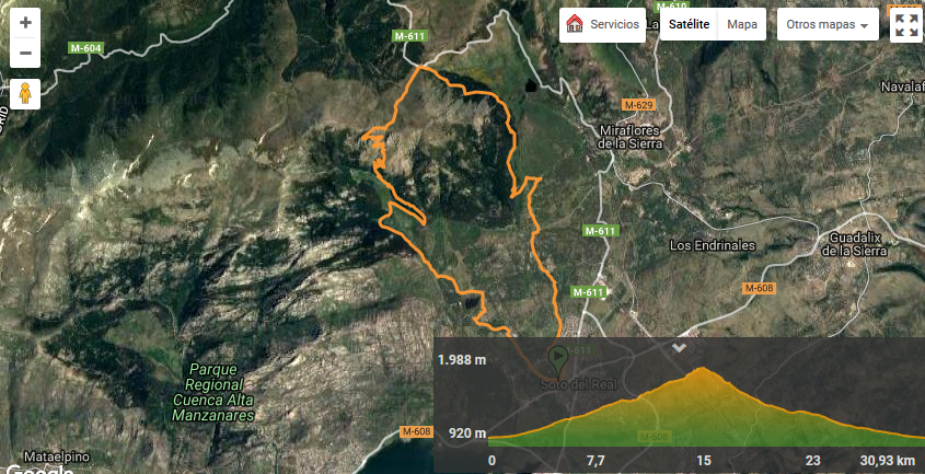
Download the whole route here.
Streams Route
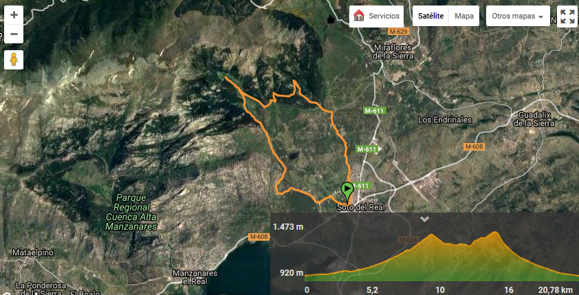
La Morcuera mountain pass
Hiking-mountain bike
Difficulty: high, very long; warm clothing recommended
Time required: 5 hours walking, 3 hours by bike.
NOTE: bicycle circulation is prohibited outside forest tracks, which should be taken into account in the final stretch of climb: continue along the track to the road. On the descent: no turning off to the right towards the Mostajo, continuing where we went up.
Download the whole route here.
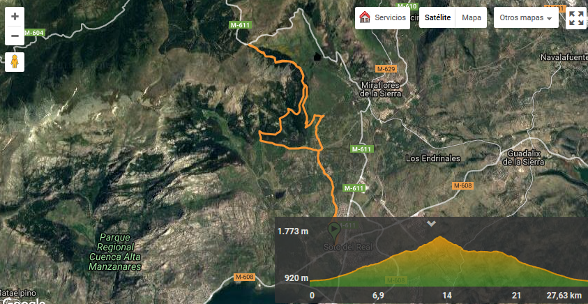
Hueco de San Blas Valley
Hiking-mountain bike
Difficulty: medium
Time required: 4-5 hours walking – 2 hours by bike
Download the whole route here.
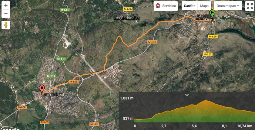
From Soto del Real to Miraflores de la Sierra by the Hueco de San Blas valley
Hiking-mountain bike
Difficulty: medium
Time required: 3-4 hours
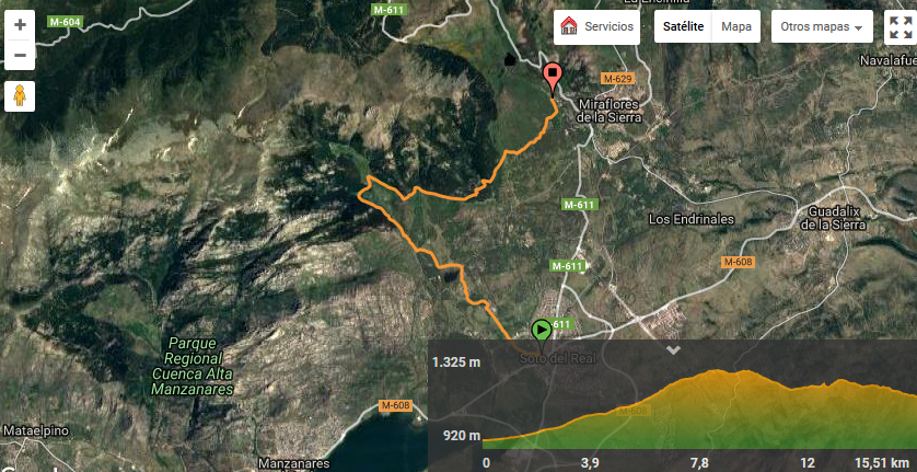
Click here to see this route in Google
From Soto del Real to Miraflores de la Sierra by the hermitage of Nuestra Señora del Rosario (Our Lady of the Rosary)
Hiking-mountain bike
Difficulty: easy
Time required: 3-4 hours
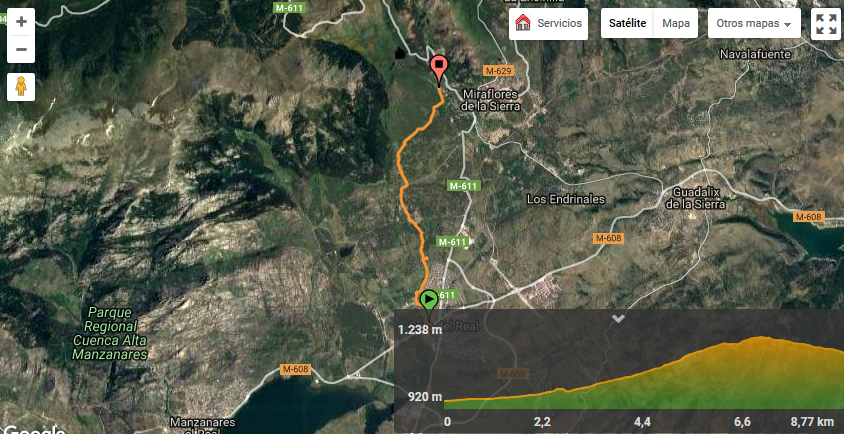
Click here to see this route in Google
Camino Mendocino to Santiago de Compostela
The current Camino Mendocino to Santiago de Compostela leaves from the city of Guadalajara and runs through the towns of Marchamalo, Usanos, Fuentelahiguera de Albatages, Viñuelas, El Cubillo de Uceda, Uceda, Torremocha de Jarama, Torrelaguna, Redueña, Venturada, Guadalix de la Sierra, Soto del Real and Manzanares el Real, where it meets the Camino de Madrid.
Click here to know all the details of the route.